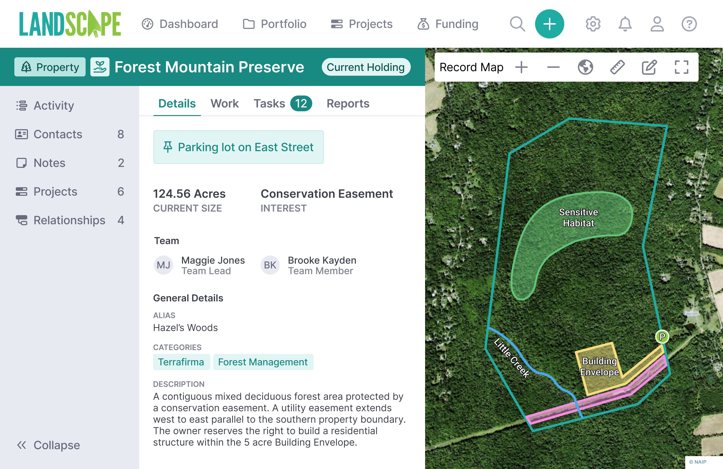
Case Study: How The Trustees Used Landscape to Transform a Complex BDR Process
One organization has harnessed the powerful data-capturing abilities of Landscape to optimize Baseline Documentation Report creation


"Landscape is a game changer – with everything we need for inspections housed in one place and accessible through an easy-to-navigate user interface, we have been able to simplify our workflow and dramatically increase our efficiency in the office and in the field."
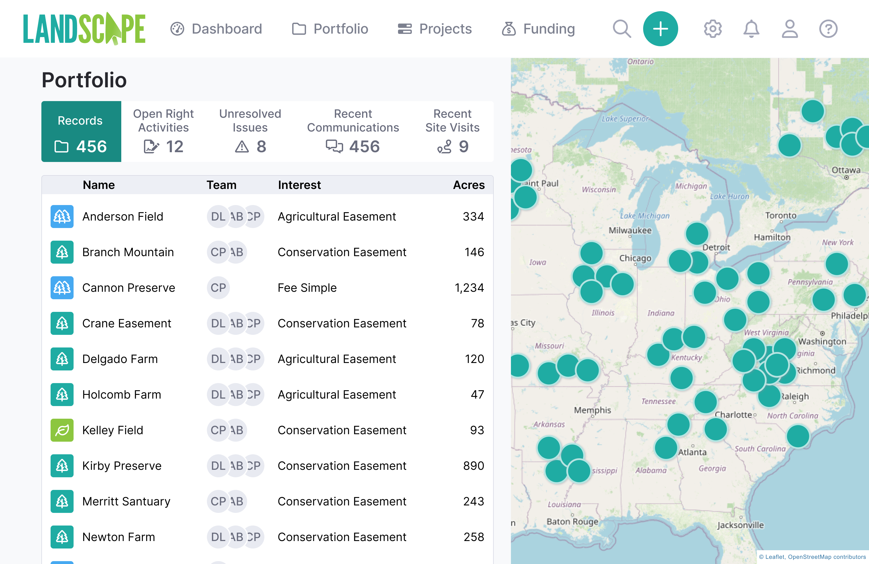
"Landscape enabled us to compile our project information from many spreadsheets into one source and easily and readily access data. The query functions have been immensely useful. I recommend Landscape to any organization that needs to organize their data."
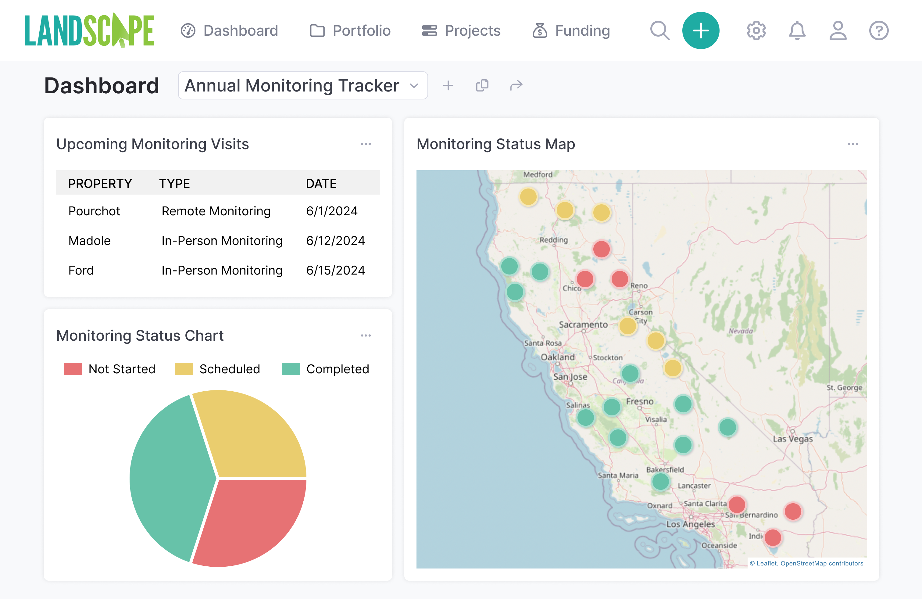
"Landscape has streamlined our monitoring and made us more consistent. It’s the best technology switch we’ve made."
“Our little land trust was growing up fast. We needed a way to clearly track and store project details and easily aggregate statistics about our projects for our Board of Directors and funders. Landscape has helped us do that beautifully."
"Using Landscape has been an absolute game changer for us. Our first year using Landscape was the first time we ever finished up in-person monitoring before hunting season and had all of our reports out the door by November 15."
"Making the transition to Landscape was an enjoyable experience - something you don't expect when switching databases."