Bring your Lens data into Landscape to connect your remote monitoring imagery and observations with your full portfolio.
What is Lens?
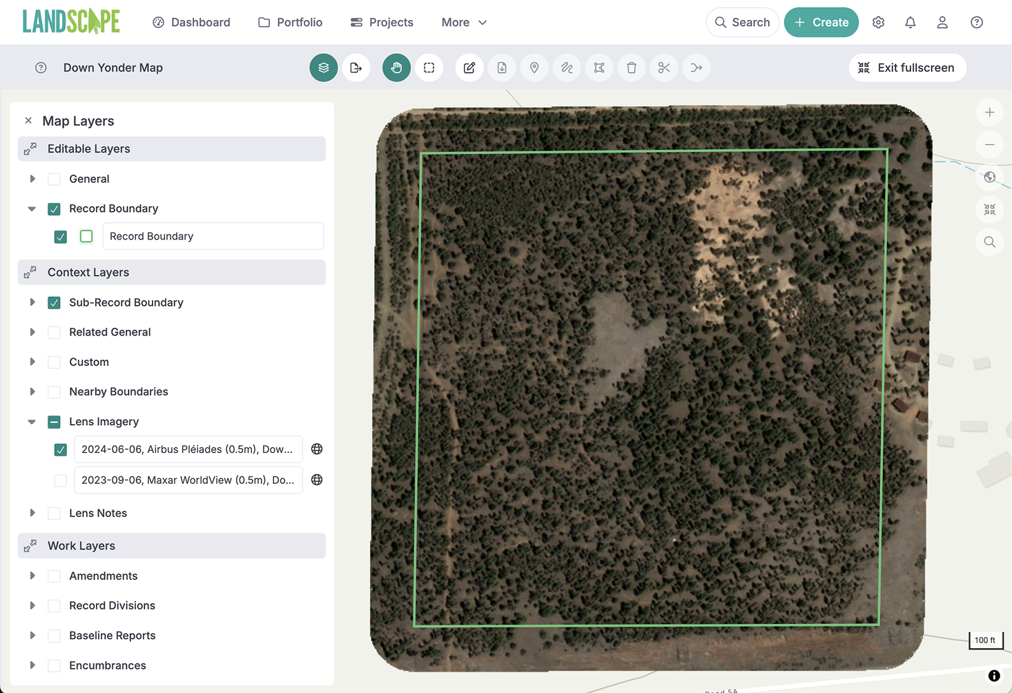
Lens by Upstream Tech is a subscription* service that allows you to purchase recent satellite and aerial imagery, record observations on changes over time, and run analysis on imagery.
*Specific Lens subscription levels allow the Landscape integration
Why Lens + Landscape?
Connect the robust imagery library and remote sensing tools of Lens with the powerful data and project management features of Landscape.
Gain efficiency in your monitoring work by bringing Lens imagery and observations into Landscape
Complete full reports, combining the property, contact, communications, and form data from Landscape, with the latest imagery
Ground-truth remote monitoring observations using the Landscape Mobile App
Seamlessly track observations and follow up
Instantly view a live list of Lens Notes for each property in Landscape - no syncing required
Turn Lens Notes into Landscape Work to track compliance issues, exercised right requests, resources, and more.
Create custom remote monitoring report templates with property information and your obsevations
How can I use the integration?
Build complete remote monitoring reports by compiling custom forms, time tracking, property details, and observations on a satellite imagery map
Track and resolve issues including communications back and forth with the landowner and generate a report that shows observations on current imagery
Ground-truth remote monitoring observations using the Landscape Mobile App
Integration options for any team
Advanced integration upgrades allow you to visualize the imagery you purchase in Lens within Landscape maps and reports.